Headgates
Every gate where water leaves a canal to a ditch. Placed by the admin, visible to every patron.
Headgates, turnouts, ditches, and pins — in the same app where you run orders and bills. No third-party map fees, no GIS expertise required.
What the map shows
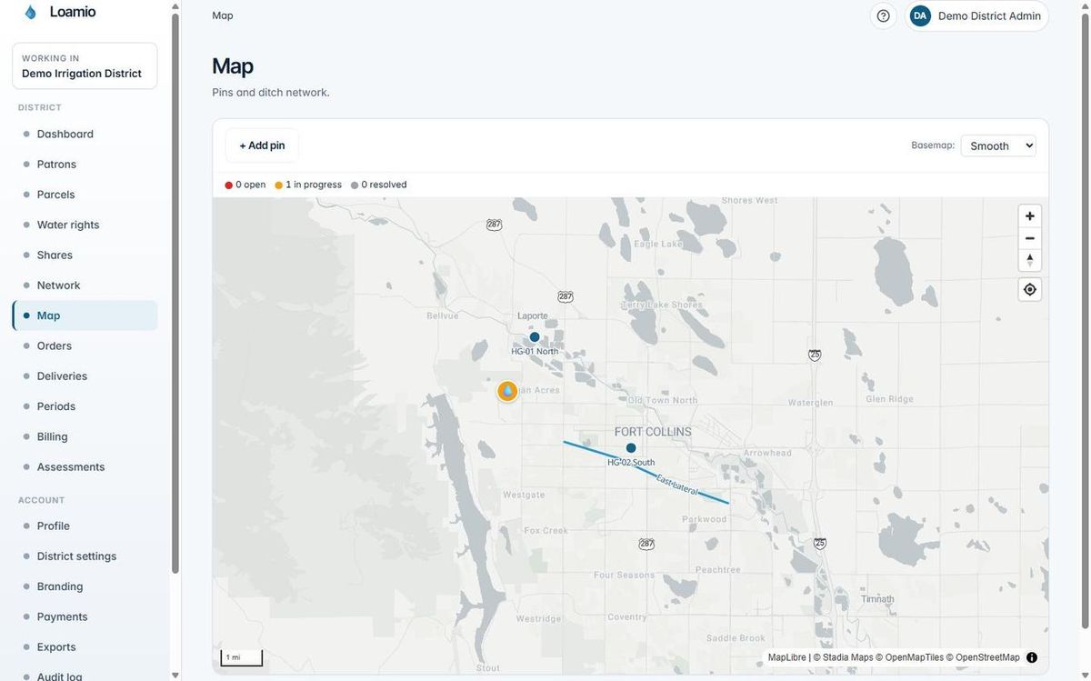
Every piece of infrastructure your district manages lives on the same map. Place features once — staff and patrons see them in the field from that moment on.
Every gate where water leaves a canal to a ditch. Placed by the admin, visible to every patron.
Every gate where water leaves a ditch to a parcel. Tap a marker to see its name and details.
The ditches themselves, drawn as lines between headgates and turnouts.
Anyone can drop a pin to point out a spot. A meeting place, a problem, a parcel corner.
For patrons (farmers)
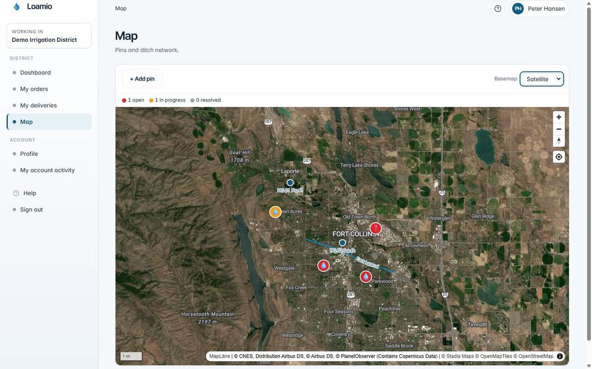
Open the map, switch to satellite view, and find your field. Tap a marker to see its name. The map works where there's no cell signal — once tiles load, they stay on the phone.
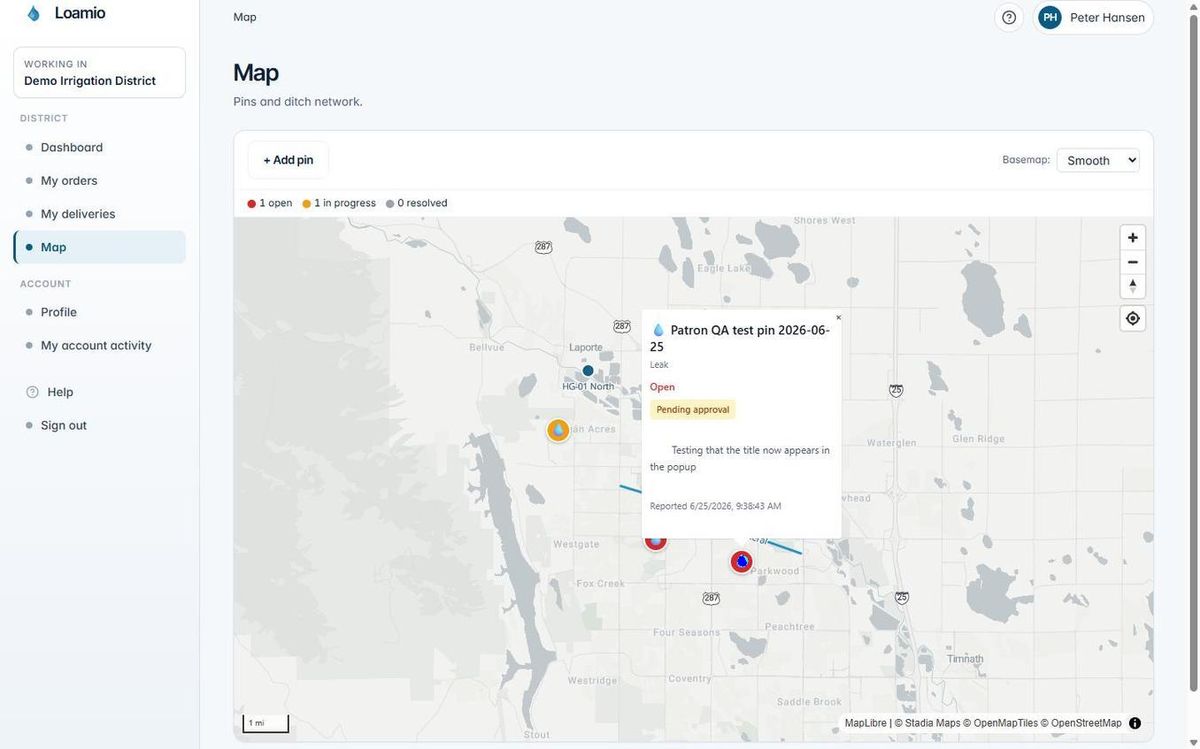
Tap any marker to see its name and details. Switch to satellite view to orient yourself by the field, not a street address.
Tap and hold to mark a meeting spot or a problem in the field. Staff see it immediately — no phone call required.
Load the map on Wi-Fi at the house. The tiles stay cached on the phone so you can open it at the headgate even without a signal.
For admins
Build the map from scratch or bring in what you already have. No GIS software or surveying background required.
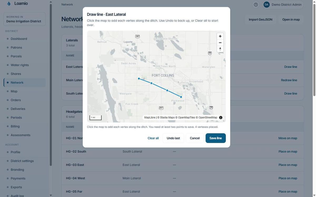
Click "Place on map" and drop the marker on the exact spot. Move it later if you need to adjust.
Click each bend in the ditch. Save. Re-open later to add segments or fix the line. Every change is visible to patrons immediately.
Already have a GeoJSON file from a surveyor or another program? Bring it in. Up to 5 MB and 5,000 features per import.
Basemaps
Switch basemaps any time. The same map data — headgates, turnouts, laterals, pins — appears over whichever background you choose.
Works offline
Once the map loads, the tiles stay on the phone. Open it on Wi-Fi at the office, then use it out where there's no signal. Headgates, turnouts, laterals, and pins are all visible — you can even drop a new pin and it syncs when you're back in range.
The whole ditchrider app is offline-first — not just the map. Mark deliveries, skip a stop, leave a note, drop a pin. Everything syncs automatically once the device is back in range.
Pricing
Other irrigation software bills you separately for Google Maps or ArcGIS map credits. As your district grows and more users open the map, those costs add up fast. Loamio doesn't charge for map usage. Maps are included in your plan — the same flat monthly price, regardless of how many patrons load the map or how often admins draw on it.
Maps are included. Lateral plan starts at $99/month. District plan at $299/month. No per-user fees, no map credit charges, no surprises.